IrrigaPlan

Planning & operations
One design. A connected workflow.
An irrigation workspace that connects site design to validation, material takeoff, estimates, and installation records.


Design
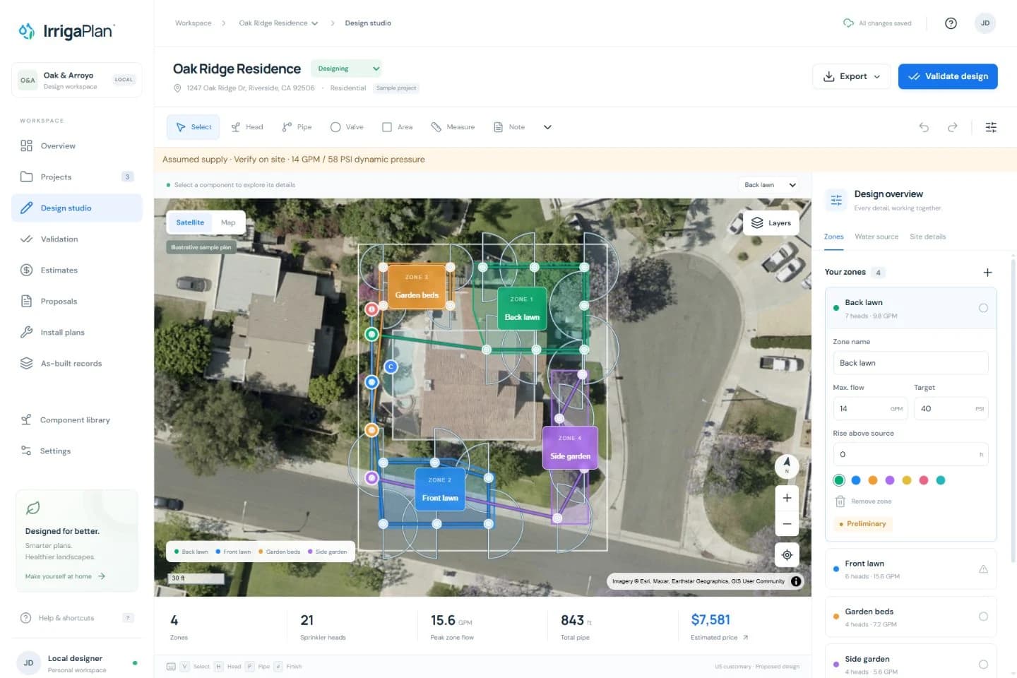
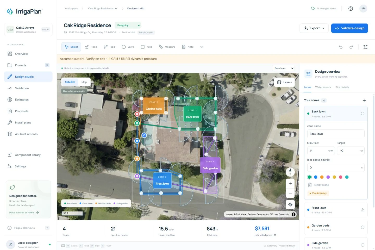
Map the site, components, and zones.
Estimate
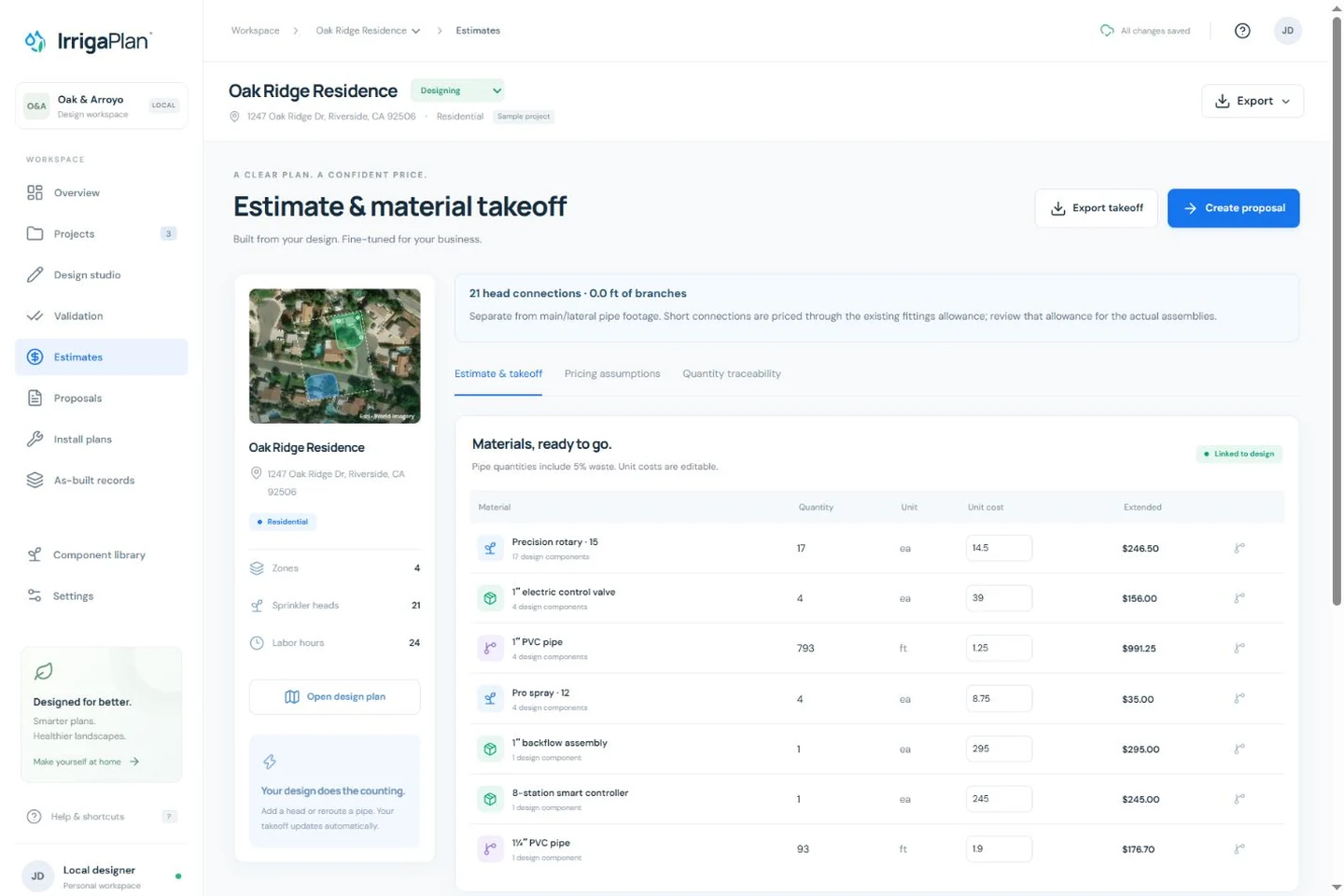
Let the design inform quantities and costs.
Handoff
Carry the plan into proposals and install notes.
- My role
- Independent product design & development
- Built for
- Landscape and irrigation planning workflows
- Tools
- Next.js · TypeScript · MapLibre · Local persistence
The problem
behind the product.
A plan is only the beginning. Components, pipe lengths, water assumptions, pricing, and field records can become disconnected as a design changes. That creates repeated work and makes it harder to explain an estimate.
The approach
Treat the design as the shared source for the rest of the workflow. Draw the site, place components, organize zones, inspect planning estimates, and turn the same design into materials, pricing, proposals, and install notes.
A few decisions
that shaped it.
01Connect geometry to quantities
Derive material takeoff from the components and pipe routes in the design. Keep quantity traceability available so an estimate can be checked against the plan.
02Make assumptions visible
Distinguish measured water supply from planning presets. Show conservative hydraulic estimates and preliminary status rather than implying engineering-certified results.
03Keep the workspace local and recoverable
Start with browser-local autosave and JSON backups. Preserve proposed designs in an independent as-built revision, and report save failures rather than silently replacing work.
From idea to interface.
Real product screens. Select an image for a closer look.
AI helps me move.
Judgment sets the direction.
AI-assisted development helps me iterate on a detailed operational interface and its underlying calculations. I focus on connecting the interaction model to domain behavior, checking quantity and pricing examples, and testing the complete path from design to deliverables.
Where it is.
Where it goes next.
The working MVP supports map editing, zones, planning validation, design-derived estimates, proposals, install notes, and as-built revisions. It runs without an account and stores projects in the current browser. It has no cloud synchronization and is not an engineering-certified installation system.
What’s next
Refine map editing and small-screen layouts, improve print framing, and continue validating the assumptions and handoff with realistic planning scenarios.
Span
Start a conversation
Good work starts
with a good question.
I’m interested in teams and people turning real problems into useful products. If that’s the work you’re doing, I’d like to hear about it.